Today I did not hike for a list, a challenge, or a view. I went because I thought the name of the mountain was funny.
Ever since one of my favorite local guide book authors, (Ken MacGray) posted a NETC report for Thumb and Skatutakee Mountains a couple of weeks back, I just knew I had to have a moment to pose with a “thumbs up” atop the southern New Hampshire peak.

I got a late start as I knew I’d spend more time driving than hiking and arrived at the Harris Center for Conservation Education by midmorning. The parking lots were plowed and full of singing and wood-pecking birds flying from tree to tree. I suited up in gaiters and microspikes, closed the trunk on the 65-liter pack I’ve been carrying since November, and went off dressed like a total trail runner, 1.5-liter vest and all.
I took to the Harriskat Trail, which rose gently over its 0.6-mile duration to the junction. Past the junction with the Thumbs Down Trial, Harriskat remained gentle in ascent and well-packed. I ran into one couple along this trail but otherwise was by myself today.

In less than an hour, I had summited Skatutakee, which provided outlooks to Temple and Pack Monadnock. Two favorites from my childhood. I shed a layer, awkwardly tied it around my vest, and embarked on the Thumbs Up Trail. Past Skatutakee, the trail was no longer firmly packed and had a mushy but not post-hole soft snow. I still remain unsure if snowshoes actually would’ve helped or not, but by the time this trail report is out, one will need snowshoes to maneuver the forecasted 12-18” this evening.
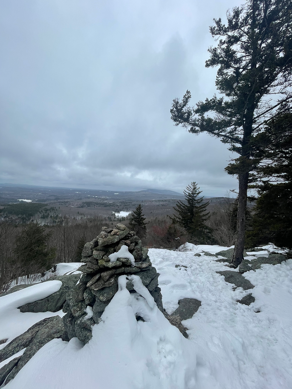
The mostly flat and wooded ridge carried me to the spur for Thumb Mountain swiftly, and only required a ¼ mile, 6-minute climb to the summit. From here, I could see south to Monadnock, which was well-socked-in and resembled Mount Mansfield without its notable rocky-summit in view. Or maybe that’s just the Vermont in me, I have a view of Mansfield from my dorm on the one day a week it’s not cloudy in Colchester!

On the way back to the car, Thumbs Down Trail, of course, the snow was less loose and I moved easily towards a small wetland area and past many more well-blazed sections of trails that brought me right back to the initial junction.

In the final minutes of the trail, I saw all sorts of unexpected animals. But, I wouldn’t want to spoil you all by sharing what I saw. So, I suppose you’ll need to explore for yourself. I could not recommend it more if you want a quick hike close to home or are looking for an introductory hike with elevation!
Final Stats: 5.09 miles, 832 gain, 4 crazy creatures
Comments